Agusan del Norte
| Agusan del Norte | |||
|---|---|---|---|
| — Province — | |||
|
|||
 |
|||
| Coordinates: | |||
| Country | |||
| Region | Caraga (Region XIII) | ||
| Founded | June 17, 1967 | ||
| Capital | Butuan City ‡ Seat of government: Butuan City |
||
| Government | |||
| - Governor | Erlpe John Amante (Lakas-Kampi-CMD) | ||
| Area | |||
| - Total | 2,730.24 km2 (1,054.2 sq mi) | ||
| Area rank | 51st out of 80 | ||
| Population (2007) | |||
| - Total | 314,027 | ||
| - Rank | 64th out of 80 | ||
| - Density | 115/km2 (297.9/sq mi) | ||
| - Density rank | 61st out of 80 | ||
| Divisions | |||
| - Independent cities | 1 | ||
| - Component cities | 0 | ||
| - Municipalities | 11 | ||
| - Barangays | 166 including independent cities: 252 |
||
| - Districts | 1st and 2nd districts of Agusan del Norte (shared with Butuan City) | ||
| Time zone | PHT (UTC+8) | ||
| ZIP Code | |||
| Spoken languages | Cebuano, Butuanon | ||
| ‡ As per RA 8811, Cabadbaran is the officially-designated capital of the province. However, the provincial government still holds office in Butuan City, pending the actual transfer of provincial offices to the new capital. | |||
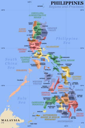
Agusan del Norte (Filipino:Hilagang Agusan) is a province of the Philippines located in the Caraga region in Mindanao. Its capital is Cabadbaran and it borders Surigao del Norte to the north, Surigao del Sur to the east, Agusan del Sur to the south, and Misamis Oriental to the west. It faces Butuan Bay, part of the Bohol Sea, to the northwest.
Contents |
Demographics
The population of Agusan del Norte (excluding Butuan City) was 314,027 at the 2007 census, making it the country's 64th most populous province. The population density is 115 per km².
Economy
The economy of Agusan del Norte is dominantly agricultural, and it is the nation's leading producer of rice.
Geography
Political
Agusan del Norte is divided into 10 municipalities and one component city. The highly-urbanized city of Butuan, being geographically located in Agusan del Norte, is traditionally grouped with the province, although it is governed independently from it.
| Municipality/City | No. of Barangays |
Area (km²) |
Population (2000) |
Pop. density (per km²) |
|---|---|---|---|---|
| Buenavista |
|
|
|
|
| Cabadbaran City |
|
|
|
|
| Carmen |
|
|
|
|
| Jabonga |
|
|
|
|
| Kitcharao |
|
|
|
|
| Las Nieves |
|
|
|
|
| Magallanes |
|
|
|
|
| Nasipit |
|
|
|
|
| Remedios T. Romualdez |
|
|
|
|
| Santiago |
|
|
|
|
| Tubay |
|
|
|
|
Physical
Located in the northeastern part of Mindanao, it is bounded on the north by Butuan Bay and Surigao del Norte; east by Surigao del Sur; west by Misamis Oriental; and south and southwest by Agusan del Sur. Agusan del Norte occupies a total land area of 2,503.9 sq. kilometers.
History
In 1942, the Japanese Imperial forces landed in Northern Agusan.
In 1945, Philippine Commonwealth Army soldiers together with the recognized Agusan guerrillas against the Japanese forces beginning the liberation in Northern Agusan during World War II.
Created by Republic Act 4979 from Agusan province.
On August 16, 2000. The seat of provincial government was transferred from Butuan City to Cabadbaran by virtue of Republic Act 8811, although the province is yet to complete the transfer of provincial services and functions to the new capital.
Tourism in AgNor
The province of Agusan del Norte is said to have many beautiful beaches such as in the town of Carmen, Buenavista, Nasipit, Cabadbaran City and all other towns in the province. It also has the majestic Mount Hilong-Hilong in Cabadbaran, one of the tallest in Agusan del Norte.
Notable schools
Elementary
- Carmen Central Elementary School
- Nasipit Central Elementary School - (West Nasipit District)
- North Cabadbaran Central Elem. School
- Cabadbaran South Central Elem. School
- Buenavista Special Education Integrated School(SPED-IS)
- Buenavista Central Elem. School
- Magallanes Central Elem. School
- Agay Central Elem. School
- Jaliobong Elementary School
Secondary
- Immaculate Heart of Mary Academy-Kitcharao INC.
- Carmen Academy
- Candelaria Institute
- Saint Michael College of Caraga
- Saint James High School
- NORMISIST-Cabadbaran
- Nasipit National Vocational School
- Mindanao Institute
- Buenavista Institute
- Magallanes National High School
- Buenavista National High School
- Agay National High School
- Jaliobong National High School
Tertiary
- Northern Mindanao School of Fisheries
- Saint Michael College of Caraga
- NORMISIST-Cabadbaran
External links
|
|||||

